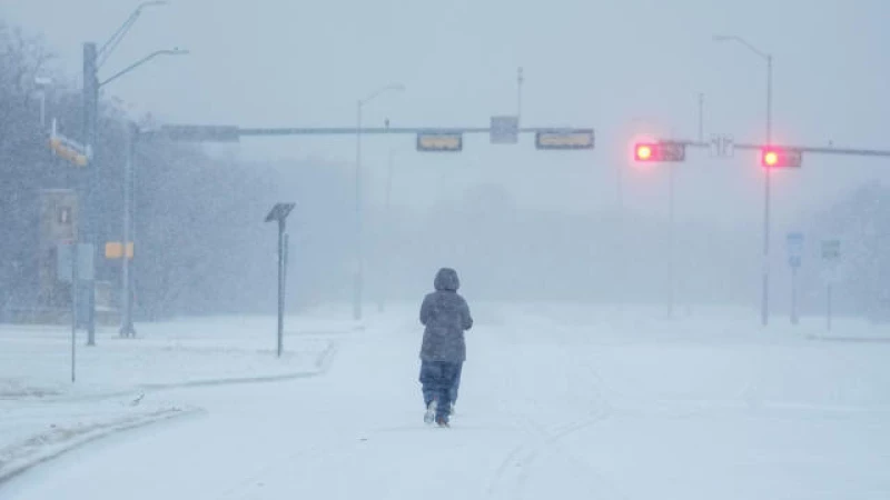
A blast of frigid Arctic air traveling southward from Canada has forced temperatures down to record lows across the U.S., causing a dangerous range of winter storm weather that impacted huge sections of the country over the weekend. The low temperates are continuing to run their course today. How cold it will be varies by region, and forecasters have warned that conditions could get worse in some places later this week.
The storm that already blanketed parts of the Midwest, Great Plains and Northeast with snow on Saturday and Sunday was driving "dangerously cold temperatures" in much of the U.S." as it moved east on Monday, "with new records expected to be tied or broken," the National Weather Service said in an advisory issued after midnight.
Snow was developing quickly over a number of states as the storm moved through the middle of the country toward the Northeast, with meteorologists reporting snowfall rates that occasionally approached 1 inch per hour on Monday afternoon.
Record snowfall, freezing rain
Snow and freezing rain were forecasted to continue in southern states, such as Texas, before spreading over the Mid-Atlantic and Northeast through Tuesday, hitting Washington, D.C., Philadelphia and New York. The weather service bureau in Philadelphia said it was expecting the incoming snowfall to break a 714-day record stretch without at least an inch of snow in the city.
Heavy snowfall was ongoing Monday in the Great Lakes, interrupting travel and, in places like Chicago, forcing school closures as wind chills dropped to -30 degrees Fahrenheit. Meteorologists said the most significant snowfall would happen over northern Michigan and western upstate New York, including Buffalo, and advised communities to brace for ongoing hazards through Wednesday.
The first of two freezing Arctic blasts was fueling wintry conditions in the lower Mississippi Valley and the Tennessee Valley on Monday, bringing a mixture of snow, sleet and freezing rain as the weather system tracked toward the Appalachian region, the weather service said, noting that a second Arctic airmass would likely arrive in the U.S. later this week after the first tapers off.
"These wind chills could cause frostbite on exposed skin in a few minutes and hypothermia shortly thereafter. Avoid outside activities if possible. If you must be outside, wear appropriate clothing, dress in layers, and cover exposed skin. Keep pets indoors. Have a cold survival kit if you must travel," the weather service said.
Subzero temperatures
Temperatures at Rapid City airport in South Dakota already hit a daily record low on Sunday when it was recorded at -23 degrees, according to the local weather service bureau there. Temperatures across Missouri, as well as parts of Kansas and Ohio, were expected to drop below 10 or 15 degrees at their lowest and linger either around or below freezing at their highest through Wednesday. In Alabama and Mississippi, governors declared states of emergency in response to freezing weather.
The National Weather Service in Jackson issued an "extreme threat" warning on Monday for a large band of Ohio, which includes Cleveland. Wind chills there could drop to -10 degrees — cold enough to cause frostbite in half an hour or less and cause hypothermia with prolonged exposure to the elements. A "significant threat" warning was in place for Missouri and eastern Kansas, where temperatures could be a few degrees higher than Cleveland's forecast with similar wind chills.
During the chilliest days of the current cold front, states like Montana could see temperatures drop as low as -40 degrees, CBS News partner The Weather Channel reported. The National Weather Service previously warned that wind chills in that area could be even colder, saying they could be as low as -70 degrees in some places, in an advisory issued early Sunday.
Along the northern part of the Gulf Coast, from eastern Texas to northern Florida, the coldest temperatures were expected to drop to low 20s, or possibly slightly lower, according to Weather Channel meteorologists. Meanwhile, in the deep South, forecasts suggested temperatures would fall between 10 and 20 degrees, with single-digit readings in some areas.
Extreme Weather Alert
Portions of the Texas panhandle, Oklahoma and northern Arkansas could see subzero temperatures, and just slightly north, lows as cold as -20 were possible in Iowa and Nebraska. The Iowa caucuses on Monday night could be held amid new record-low temperatures. In Chicago, where air temperatures reached -9 degrees, meteorologists noted that although a record had not yet been broken, the freeze was approaching some of the city's coldest days in recorded history.
"Significant ice"
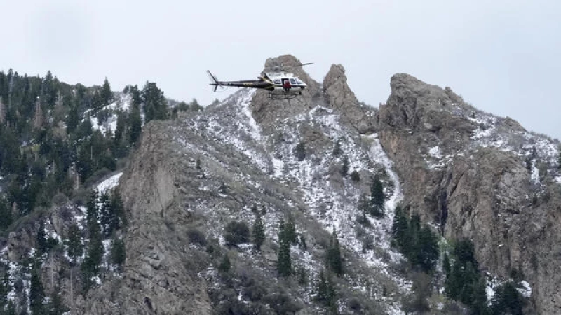
Along the West Coast, forecasters warned people to prepare for another bout of extreme weather come Tuesday, owing to another storm system coming onshore over the Pacific Northwest that was expected to drop freezing rain on southerwestern Washington and northwestern Oregon, where the storm Saturday caused a tree to fall down onto a home, killing an elderly man inside. The National Weather Service in Portland said Monday that ice accumulations in those areas could be as high as half an inch, making for "extremely dangerous" travel conditions.
Parts of California will likely see rainfall as well, and high elevation areas in all three states will get snow, the weather service said, adding that "the combination of snow and ice may cause hazardous road conditions through this region."