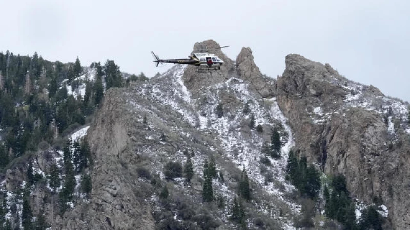
Reports of tornadoes touching down Monday evening in rural Oklahoma and large hail pelting parts of Kansas have emerged as an outbreak of dangerous storms sweeps through the region, bringing the possibility of strong twisters staying on the ground for many miles.
A rare high-risk weather warning has been issued by forecasters for the two states, marking the first such warning for Oklahoma in five years.
The National Weather Service emphasized the urgency of the situation, stating, "You can't rely on waiting to see tornadoes before sheltering tonight."
Oklahoma finds itself under a Particularly Dangerous Situation (PDS) watch, the second in just nine days. The previous PDS watch in the state resulted in four deaths and 22 confirmed tornadoes last month.
Multiple tornadoes have already been reported in north central Oklahoma, with one located approximately a 45-minute drive north of Tulsa. The National Weather Service office in the area issued a tornado emergency alert Monday night for the nearby towns of Bartlesville, Dewey, and Barnsdall.
Residents were warned of "a large and life-threatening tornado" heading towards those towns, accompanied by wind gusts of up to 70 mph.
Additional tornadoes were sighted earlier in the evening near the 1,000-person town of Okeene, while another storm in Covington had been "producing tornadoes off and on for over an hour."
The greatest risk of damaging weather includes areas in Oklahoma, such as Sulphur and Holdenville, still recovering from a tornado that killed four and left thousands without power late last month. Both the Plains and Midwest have been hammered by tornadoes this spring.
The Weather Service said that more than 3.4 million people, 1,614 schools and 159 hospitals in Oklahoma, portions of southern Kansas and far north Texas, face the most severe threat for tornadoes.
Schools and colleges across the state, including the University of Oklahoma, Oklahoma City Public Schools and several metro-area school districts, shut down early and canceled late afternoon and evening classes and activities.
Oklahoma's State Emergency Operations Center, which coordinates storm response from a bunker near the state Capitol, remains activated from last weekend's deadly storms, and the state's commissioner of public safety told state agencies to let most of their workers across Oklahoma leave early on Monday.
Monte Tucker, a farmer and rancher in the far western Oklahoma town of Sweetwater, spent Monday putting some of his tractors and heavy equipment in barns to protect it from hail and letting his neighbors know they can come to his house if the weather becomes dangerous.
"We built a house 10 years ago, and my stubborn wife put her foot down and made sure we built a safe room," Tucker said. He said the entire ground-level room is built with reinforced concrete walls.
"It's the highest level of threat we can assign. And it's a day to take very, very seriously," he said.
The last time a high risk was issued was March 31, 2023, when a massive storm system tore through parts of the South and Midwest including Arkansas, Illinois and rural Indiana.
The risk on Monday in parts of the southern Plains is the worst in five years, AccuWeather Chief Meteorologist Jon Porter said.
"If you look at a meteorology textbook about how to get a significant tornado outbreak in the southern Plains, all the ingredients you need are here today," Porter said.
The number of storms and their intensity should increase quickly in the evening hours across western parts of Oklahoma and up into south-central Kansas, Bunting said.
"The types of tornadoes that this storm can generate are extremely powerful and have the potential to last for an extended period," Porter explained. "These tornadoes are known to persist for 45 minutes to an hour, or even longer, leaving a trail of destruction in their path."
The heightened risk is attributed to a unique combination of factors: Strong winds reaching up to approximately 75 mph have been sweeping through Colorado's densely populated Front Range area, including Denver, on Monday.
These winds are a result of a low-pressure system situated north of Colorado, which is also drawing moisture from the Gulf of Mexico, increasing the likelihood of severe weather on the Plains, according to Greg Heavener, warning coordination meteorologist at the National Weather Service's Denver office.
Heavener stated that Colorado itself is not under threat of tornadoes or thunderstorms.
The hazardous weather conditions on the Plains are expected to shift eastward, posing a potential overnight risk in areas such as Kansas City and Springfield in Missouri by early Tuesday, Porter mentioned.
"This weather pattern will not diminish as night falls, and there will continue to be a risk of severe weather," emphasized Victor Gensini, a meteorology professor at Northern Illinois University.
Prepare for a stormy week ahead as the entire U.S. is set to experience turbulent weather. The eastern U.S. and the South will bear the brunt of the bad weather in cities like Indianapolis, Memphis, Nashville, St. Louis, and Cincinnati, where over 21 million people reside. Fortunately, the skies are expected to clear up by the weekend.
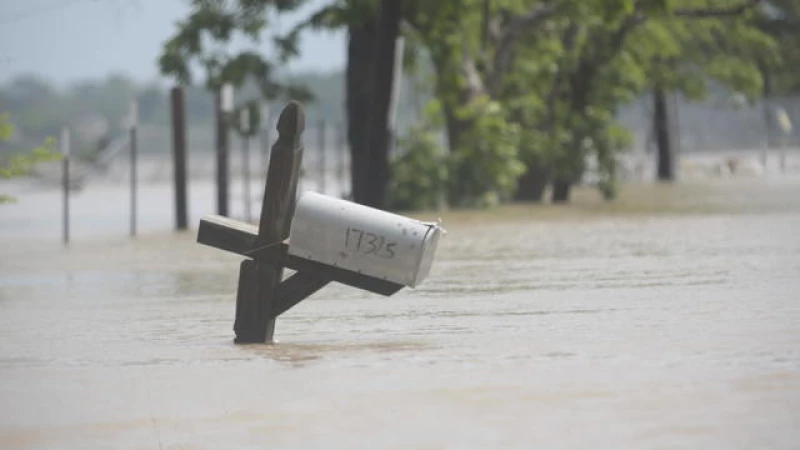
On the other hand, the Houston area is finally seeing relief as floodwaters began to recede on Monday. The region had been inundated with heavy rain, causing widespread flooding and necessitating numerous high-water rescues.