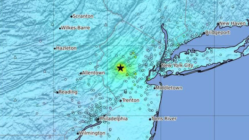
Residents across the Northeast were rattled by a 4.8 magnitude earthquake that shook the densely populated New York City metropolitan area and much of the surrounding region on Friday morning. The U.S. Geological Survey was quick to release maps showing the spot where the quake was centered, in New Jersey, and the area where it was felt.
The USGS reported the quake occurred about 7 miles north of Whitehouse Station, New Jersey. It indicated that the quake might have been felt by more than 42 million people.
People in Baltimore, Philadelphia, New Jersey, Connecticut, Boston, and other areas reported feeling the earthquake.
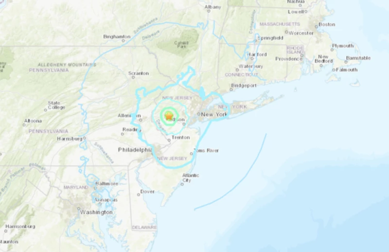
The map below shows the seismic intensity of the earthquake. The map, which is mostly a lighter shade of blue, shows that the intensity was light to weak, depending on the distance from the epicenter.
Another map released 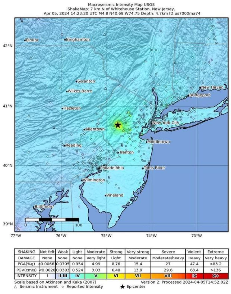
New York Gov. Kathy Hochul and New York City Mayor Eric Adams have been briefed on the quake.
"The situation is being treated with the utmost seriousness, and here's why: the threat of aftershocks is always present. It has been nearly a decade since we last experienced an earthquake of this magnitude," stated Hochul.
The earthquake caught people off guard across the region. A resident of New York City shared with CBS New York's Elijah Westbrook, "I was in my bed when suddenly my entire building started shaking. It was a terrifying experience,"
This is not the first time that the East Coast and New York City have felt the impact of an earthquake.
A 5.0 magnitude earthquake struck New York City back in 1884.
The recent tremors brought back memories of the earthquake on Aug. 23, 2011, which affected millions of people from Georgia to Canada. With a magnitude of 5.8, it was the most powerful earthquake to hit the East Coast since World War II, originating in Virginia.
That earthquake caused damage to the Washington Monument, led to the evacuation of the White House and Capitol buildings, and shook New Yorkers just three weeks before the 10th anniversary of the September 11 attacks.